


The Rock County Public Health Department is making more specific COVID-19 location data available to the public.
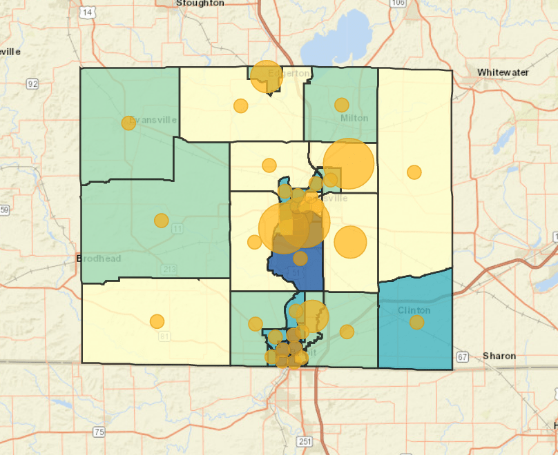
Health officials released a new map Thursday showing the positive coronavirus cases organized by census tract.
The map data points do not identify any specific addresses of COVID-19 patients, but it shows which areas of Rock County cities have greater outbreaks.
The census tract mapping confirms the conclusions of the zip code map, which show more cases hitting Janesville’s south side and the Town of Harmony. Western Rock County appears to have the fewest COVID-19 cases.
It also measures the CDC’s social vulnerability index, measuring factors like poverty, transportation and housing. The south side of Janesville and much of the City of Beloit show the highest vulnerability according to the data.